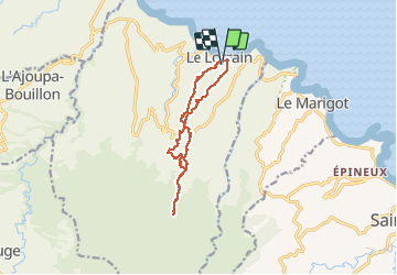
![](/images/other/stat-length.png)
![Excursión Senderismo Le Lorrain - Boucle Prébour -- Carabin - Photo](https://media.geolcdn.com/t/1900/400/6b7f42d8-96f7-489d-ba60-7732950f3a6a.jpg&format=pjpeg&maxdim=2)
Boucle Prébour -- Carabin
Lamartiniere
Usuario GUIDE
![Longitud](/images/other/stat-length.png)
![Altitud máxima](https://static1.geolcdn.com/siteimages/upload/files/1508320355ic_sort_altitude_max_24dp.png)
![Desnivel positivo](https://static1.geolcdn.com/siteimages/upload/files/1508320355ic_sort_den_pos_24dp.png)
![Km-Effort](/images/other/stat-length.png)
![Altitud mínima](https://static1.geolcdn.com/siteimages/upload/files/1508320355ic_sort_altitude_min_24dp.png)
![Desnivel negativo](https://static1.geolcdn.com/siteimages/upload/files/1508320355ic_sort_den_neg_24dp.png)
![Boucle](https://static1.geolcdn.com/siteimages/upload/files/16400158638029165_repeat_loop_refresh_sync_direction_icon.png)
![Senderismo](https://static1.geolcdn.com/sitytour/trail-icons/101.png)
4h30
Dificultad : Difícil
![Escanee este código QR para abrir la excursión en la aplicación SityTrail](https://capi.geolives.com/qq0zvz2zws4bq2lad0pu/sitytour/trails/2772021/qr.png?size=200)
Aplicación GPS de excursión GRATIS
A propósito
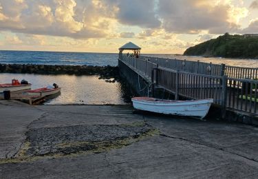
Ruta Senderismo de 15,5 km a descubrir en Martinica, Desconocido, Le Lorrain. Esta ruta ha sido propuesta por Lamartiniere.
Descripción
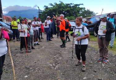
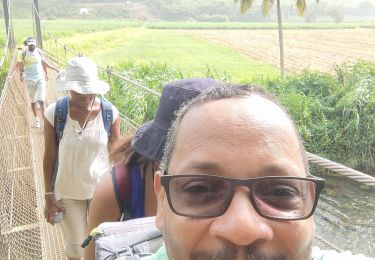
Rando de 15 km environ. Départ rue des Sapotilles, Morne Céron, La Moreau, les mornes Octave et Gustave, Carabin, direction Morne Jacob, Bois Cledelin, morne Quatre Vingt, demi tour. Après panneau Morne Jacob, route Carabin. A Croisé Quatre prendre route vers Morne Céron et se diriger vers Vallon, route de Castel Brando, cité Cheneux, arrivée rue de Sapoilles.
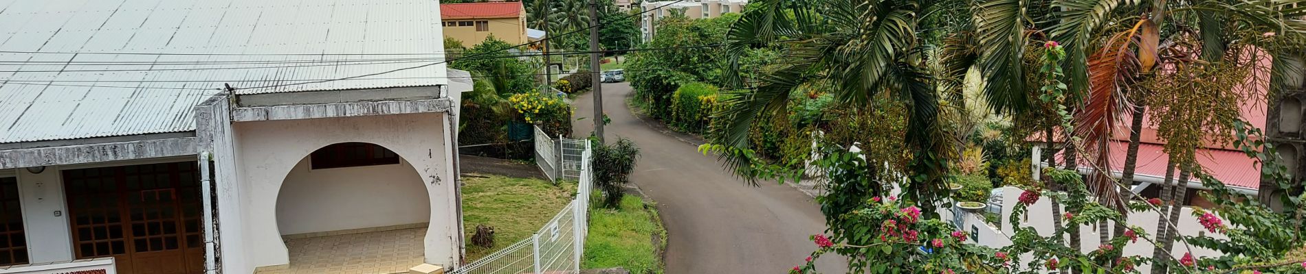
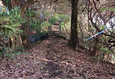
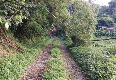
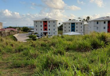
Localización
Comentarios
Excursiones cerca
![Excursión Senderismo Le Lorrain - Boucle Lorrinoise via Morne Wawa - Photo](https://media.geolcdn.com/t/375/260/2260d5fa-b236-443e-94b6-198d12135800.jpg&format=jpg&maxdim=2)
![Senderismo Senderismo](https://static1.geolcdn.com/sitytour/trail-icons/101.png)
Senderismo
![](/images/other/stat-length.png)
![](https://static1.geolcdn.com/siteimages/upload/files/16400158638029165_repeat_loop_refresh_sync_direction_icon.png)
![Excursión Senderismo Le Lorrain - Boucle Morne Capot via La Pirogue - Photo](https://media.geolcdn.com/t/375/260/88d336cd-6544-44b1-ab6c-880c93dcc1a4.jpg&format=jpg&maxdim=2)
![Senderismo Senderismo](https://static1.geolcdn.com/sitytour/trail-icons/101.png)
Senderismo
![](/images/other/stat-length.png)
![](https://static1.geolcdn.com/siteimages/upload/files/16400158638029165_repeat_loop_refresh_sync_direction_icon.png)
![Excursión Senderismo Le Marigot - Boucle Le Mariigot - Charpentier - SLNA. - Photo](https://media.geolcdn.com/t/375/260/b4acbe47-87c5-4bec-aa83-83441bd5fc60.jpg&format=jpg&maxdim=2)
![Senderismo Senderismo](https://static1.geolcdn.com/sitytour/trail-icons/101.png)
Senderismo
![](/images/other/stat-length.png)
![](https://static1.geolcdn.com/siteimages/upload/files/16400158638029165_repeat_loop_refresh_sync_direction_icon.png)
![Senderismo Senderismo](https://static1.geolcdn.com/sitytour/trail-icons/101.png)
Senderismo
![](/images/other/stat-length.png)
![](https://static1.geolcdn.com/siteimages/upload/files/16400158638029165_repeat_loop_refresh_sync_direction_icon.png)
![Excursión Senderismo Le Lorrain - Mornes Capot / Lorrain Martinique - Photo](https://media.geolcdn.com/t/375/260/bf3e9288-2731-4804-b2e5-dccb9a2b816e.jpg&format=jpg&maxdim=2)
![Senderismo Senderismo](https://static1.geolcdn.com/sitytour/trail-icons/101.png)
Senderismo
![](/images/other/stat-length.png)
![](https://static1.geolcdn.com/siteimages/upload/files/16400158638029165_repeat_loop_refresh_sync_direction_icon.png)
![Excursión Senderismo Basse-Pointe - Boucle de chalvet, Pécoule vers Chalvet. - Photo](https://media.geolcdn.com/t/375/260/1e4cabaa-63c0-46f7-b111-2c87348cf0ee.jpg&format=jpg&maxdim=2)
![Senderismo Senderismo](https://static1.geolcdn.com/sitytour/trail-icons/101.png)
Senderismo
![](/images/other/stat-length.png)
![](https://static1.geolcdn.com/siteimages/upload/files/16400158638029165_repeat_loop_refresh_sync_direction_icon.png)
![Excursión Senderismo Le Marigot - Marigot vers le Lorrain - Photo](https://media.geolcdn.com/t/375/260/6a93875e-8aed-454e-924f-79cf5824df2f.jpg&format=jpg&maxdim=2)
![Senderismo Senderismo](https://static1.geolcdn.com/sitytour/trail-icons/101.png)
Senderismo
![](/images/other/stat-length.png)
![](https://static1.geolcdn.com/siteimages/upload/files/16400158638029165_repeat_loop_refresh_sync_direction_icon.png)
![Excursión Senderismo Le Lorrain - Boucle Seguineau 22 Mai - Photo](https://media.geolcdn.com/t/375/260/637e5e8f-3e66-4461-a851-15be19fa887e.jpg&format=jpg&maxdim=2)
![Senderismo Senderismo](https://static1.geolcdn.com/sitytour/trail-icons/101.png)
Senderismo
![](/images/other/stat-length.png)
![](https://static1.geolcdn.com/siteimages/upload/files/16400158638029165_repeat_loop_refresh_sync_direction_icon.png)
![Excursión Senderismo Le Lorrain - Morne Jacob au Panneau ONF - Photo](https://media.geolcdn.com/t/375/260/54159292-758e-4621-a73f-109fb913bb31.jpg&format=jpg&maxdim=2)
![Senderismo Senderismo](https://static1.geolcdn.com/sitytour/trail-icons/101.png)
Senderismo
![](/images/other/stat-length.png)
![](https://static1.geolcdn.com/siteimages/upload/files/16400158638029165_repeat_loop_refresh_sync_direction_icon.png)